AI field boundary detection for agricultural parcels
Deep learning models delineate field boundaries from satellite imagery so governments register parcels faster and insurers validate insured areas.
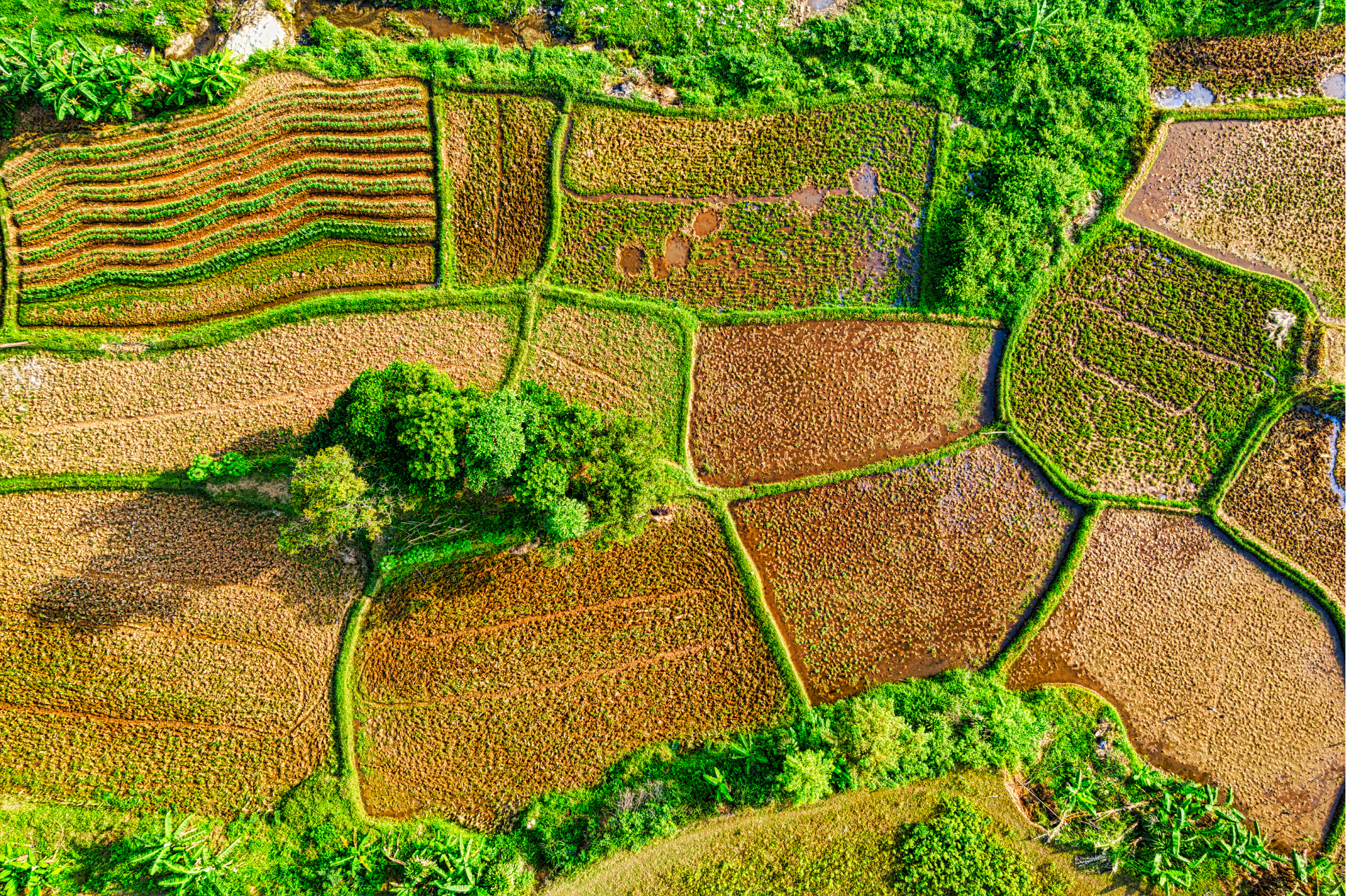
AI field boundary detection automatically delineates agricultural parcels from high-resolution satellite imagery, accelerating national registries and reducing manual digitizing costs by up to 60%.
Manual parcel mapping does not scale
National parcel registries often rely on slow manual digitizing. Insurers struggle to verify insured hectares. Programs like Fields of the World demonstrate demand for automated boundary datasets at continental scale.
AgroPure boundary detection pipeline
Convolutional models segment fields from seasonal imagery stacks. Human reviewers correct low-confidence polygons. Outputs export to GeoJSON for GIS systems and link to crop monitoring dashboards.
Mapping program metrics
- 60% lower cost per mapped hectare vs manual digitizing
- 2.3 million hectares processed in a single national campaign
- Mean IoU above 0.82 on validation plots
- Boundary updates integrated with crop type classification
We mapped an entire province in one dry season. Manual teams would have needed three years.
GIS lead, national land administration project
Lessons for mapping teams
- Use multi-date imagery to separate fields from fallow land
- Publish confidence layers for downstream users
- Involve local agronomists to validate ambiguous polygons
- Version boundaries annually to capture parcel mergers
FAQ
What resolution is required?
3–10 m imagery is typical; higher resolution improves smallholder parcel accuracy.
How are errors corrected?
Reviewers edit polygons in AgroPure or export to desktop GIS for bulk fixes.
Can boundaries feed insurance policies?
Yes. Insurers link policies to verified polygon IDs and area calculations.
Sources and references
For GIS and data teams
Accelerate parcel registration with AI boundary detection Request a demo.